
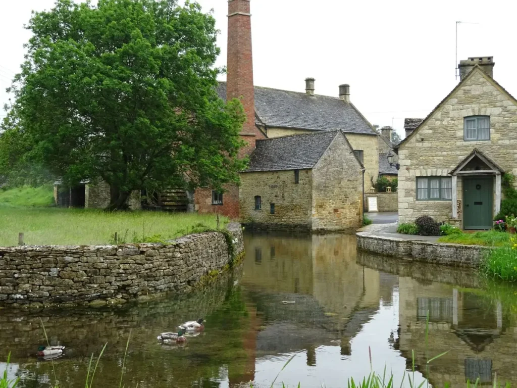
Lower Slaughter and Upper Slaughter are two Cotswold villages on the River Eye, 8 minutes by car north of Bourton-on-the-Water. A footpath and lane join them, about 1.3 kilometres or 20 minutes on foot. Allow one to two hours for both. From central London, Lower Slaughter is about 2 hours 7 minutes by car.
The Slaughters at a glance
Where: central Cotswolds, between Bourton-on-the-Water and Stow-on-the-Wold
Best known for: the brick mill and waterwheel in Lower Slaughter
Between the two: about 1.3 km on foot, 20 minutes
Time needed: 1 to 2 hours for both villages
Nearest stations: Kingham and Moreton-in-Marsh, 20 minutes by car
Locals and guidebooks call the pair “the Slaughters”. Lower Slaughter is the busier of the two, with the river running down its main street. Upper Slaughter sits further up the river and sees far fewer visitors.
Where are Lower Slaughter and Upper Slaughter?
The Slaughters are in the central Cotswolds in Gloucestershire, 8 minutes by car north of Bourton-on-the-Water and about 15 minutes south-west of Stow-on-the-Wold. Both lie inside the protected Cotswolds National Landscape, on the eastern side of the hills that face London.
| From | Time by car to Lower Slaughter |
|---|---|
| Central London | 2 hours 7 minutes, 84 miles |
| Heathrow Terminal 5 | 1 hour 47 minutes, 74 miles |
| Burford | 20 minutes |
| Bibury | 29 minutes |
| Bourton-on-the-Water | 8 minutes, 2.4 miles |
| Kingham or Moreton-in-Marsh station | 20 minutes |
- How we measured: drives for a weekday morning in November 2026.
- Upper Slaughter: 7 minutes further by car, with Stow-on-the-Wold 13 minutes beyond it.
- On the map: our map of the Cotswolds shows where the villages sit against the boundary and the stations.
Tip: there is no railway station in either village. If you come by train, book a taxi from Kingham or Moreton-in-Marsh in advance, since both are small country stations.
Why are the villages called the Slaughters?
The name has nothing to do with killing: it comes from the Saxon word “slohtre”, meaning a muddy place. Historic England traces it to the wet ground along the River Eye, the small stream that runs through both villages.
- Lower and Upper: Upper Slaughter stands higher up the valley and Lower Slaughter downstream.
- The River Eye: it runs through the middle of Lower Slaughter’s main street and past the church in Upper Slaughter.
What is there to see in Lower Slaughter?
Lower Slaughter’s main sights are the brick watermill with its waterwheel, the stone footbridges over the River Eye and St Mary’s Church. All three are within a five-minute stroll of each other along the river.
- The mill: built in the early 19th century in two parts, one red brick and one Cotswold stone. Its tall brick chimney and large iron waterwheel are on the south gable, and most of the original gearing is still inside. It is the only large brick building in the village, which is why it stands out in photographs.
- The river street: the Eye runs shallow between grass banks in the middle of the village, crossed by low stone footbridges, including a clapper bridge made of flat stone slabs.
- St Mary’s Church: rebuilt in 1867 by the architect Benjamin Ferrey, it keeps an arcade of round pillars from the late 12th or early 13th century. Its broad spire is the landmark you see from the fields.
- Protection: the mill is listed at Grade II and the church at Grade II*, the higher grade for buildings of special interest.
- Inside the mill: we could not confirm current opening times, so plan it as a sight from outside. The wheel, the chimney and the millpond are all visible from the lane.
What is there to see in Upper Slaughter?
Upper Slaughter is smaller and quieter. Its sights are St Peter’s Church on a rise above the river, a ford across the Eye and a small square of stone houses. Most people walk up from Lower Slaughter, look around for half an hour and walk back.
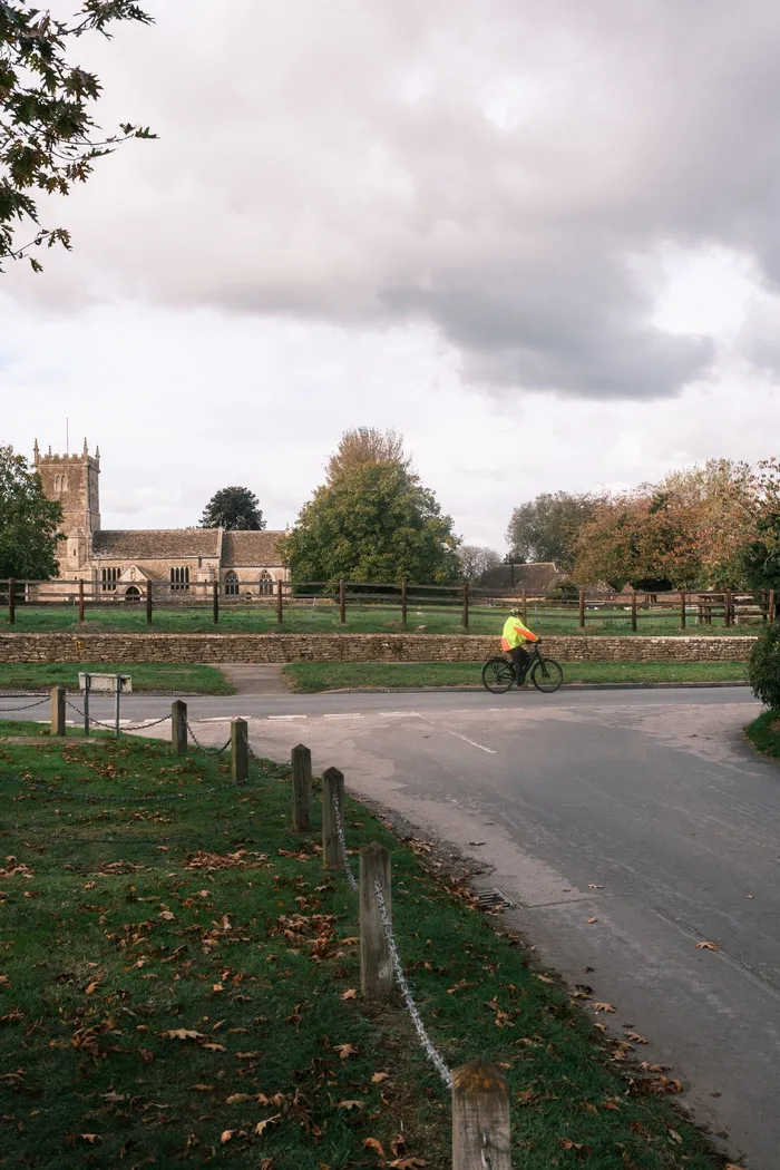
- St Peter’s Church: the nave dates from the 12th century and the church stands on high ground above the village on the south bank of the river. It is listed at Grade II*.
- The Witts chapel: a mortuary chapel added to the church in 1854 for the Reverend F. E. Witts, designed by the Gloucestershire architect Francis Niblett.
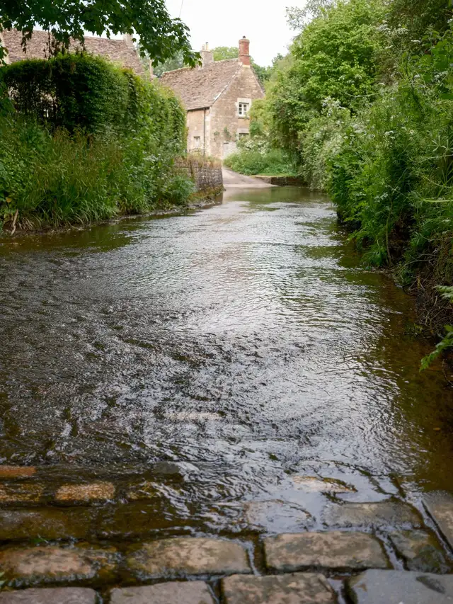
- The ford: a lane runs straight through the River Eye here, with a footbridge beside it for walkers.
Why is Upper Slaughter called a doubly thankful village?
Upper Slaughter lost no one in either world war, which makes it one of England’s few “doubly thankful” villages. In the Second World War, 36 people from the village joined up and all 36 came home.
- First World War: the plaque in the village hall lists 24 men and 1 woman who served. All came home.
- The term: the writer Arthur Mee called these places “thankful villages” in the 1930s.
- How rare: Historic England counts 53 such village communities. It believes 16 English villages and both Welsh ones also saw everyone return from the Second World War.
How do you walk from Lower Slaughter to Upper Slaughter?
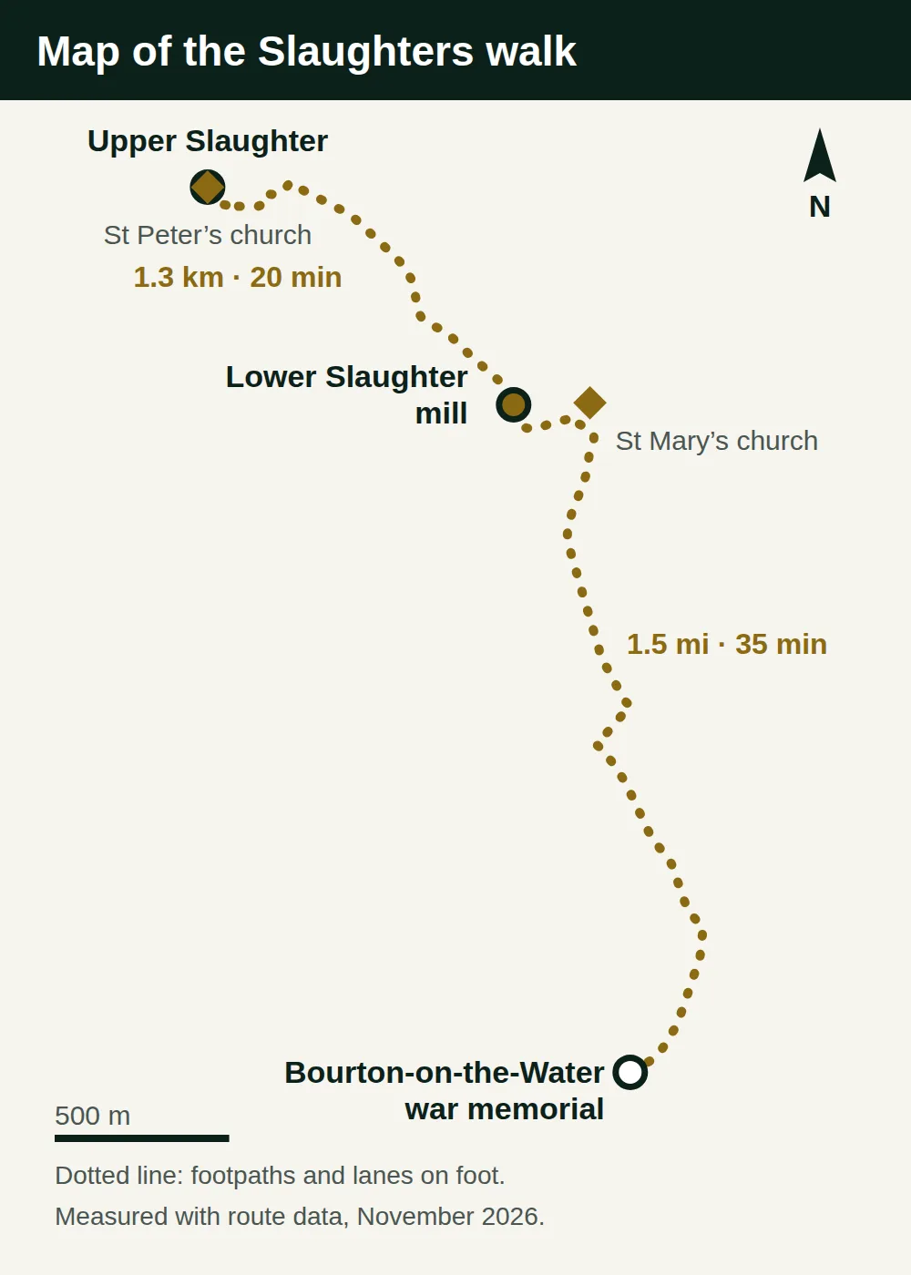
Start at the mill in Lower Slaughter and take the footpath on the left just after it. Follow it half a mile to a lane that leads into Upper Slaughter. The whole walk is about 1.3 kilometres, or 0.8 of a mile, and takes about 20 minutes each way.
- Step 1: walk upstream along the river to the mill, keeping the water on your left.
- Step 2: turn left immediately after the mill onto the signed footpath.
- Step 3: follow the path about half a mile through a series of gates and over a footbridge, up to the road.
- Step 4: turn left along the road into the village square of Upper Slaughter.
- Ground: the path crosses open fields and is muddy after rain, so wear shoes with grip outside the summer months.
- Without the walk: the drive between the villages takes 7 minutes on narrow lanes.
Can you walk from Bourton-on-the-Water to the Slaughters?
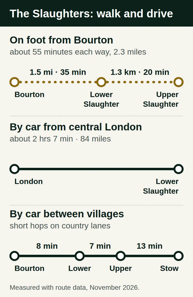
Yes: Lower Slaughter is 1.5 miles on foot from the war memorial in Bourton-on-the-Water, about 35 minutes along the Wardens’ Way. With the extra stretch to Upper Slaughter, allow about 55 minutes each way.
- Start: the war memorial by the river in Bourton. Head along the road towards St Lawrence Church and go through the church gates.
- Middle: follow the paved path, then the road to the traffic lights, and cross the main road with care.
- Finish: after 200 metres, a footpath through a gate leads across the fields into Lower Slaughter.
- Parking: leave the car at the council’s Rissington Road car park in Bourton. The council announced free parking there before 10am, with charges from 10am to 8pm.
- Longer option: the Cotswolds National Landscape publishes a circular walk from Bourton through both Slaughters and Naunton.
- Distance and time: 10.2 miles, 4 to 5 hours, with 250 metres of climb in total.
- Route: out on the Wardens’ Way and back on the Windrush Way, with stiles on the way.
How long do you need to visit the Slaughters?
One to two hours covers both villages: about 45 minutes in Lower Slaughter and an hour for the walk to Upper Slaughter and back. The shorter time is for driving between the villages; walking the footpath both ways adds about 40 minutes. These are our suggestions from the measured times, at a gentle pace with stops for photos.
| Plan | Time to allow |
|---|---|
| Lower Slaughter only: the mill, the river and the church | 30 to 45 minutes |
| Both villages, driving between them | about 1 hour |
| Both villages, walking between them | 1 hour 30 minutes to 2 hours |
| Walking from Bourton and back, both villages | 2 hours 30 minutes to 3 hours |
| The official circular walk via Naunton | 4 to 5 hours |
How do you fit the Slaughters into a day trip from London?
Visit them after lunch in Bourton-on-the-Water, which is 8 minutes away, as the last stop before the drive back to London. A comfortable day from London covers Burford, Bibury, Bourton and the Slaughters, in that order.
- Morning: Burford, then Bibury, both on the side of the Cotswolds nearest London.
- Lunch: Bourton-on-the-Water, with its river and low stone bridges.
- Afternoon: Lower Slaughter at about 1:45pm, and the walk up to Upper Slaughter if you have the energy.
- Back: about 2 hours 14 minutes to central London in afternoon traffic.
- Other stops: our guides to the best Cotswolds villages and things to do in the Cotswolds explain Burford, Bibury and Bourton in more detail.
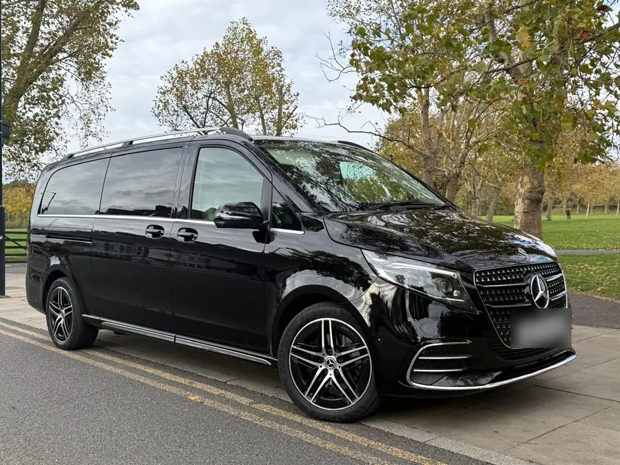
- With a driver: our private Cotswolds day trip from London costs £500 for the whole car, up to three passengers, for about nine hours. The driver collects you from your hotel and waits while you walk between the two villages.
- By train: our guide to London to the Cotswolds by car or train compares the options door to door.
FAQ: Lower and Upper Slaughter
Is Lower Slaughter worth visiting?
Yes, if you are already near Bourton-on-the-Water. Lower Slaughter is 8 minutes away by car, takes under an hour to see, and has the brick mill and waterwheel that appear in many Cotswolds photographs. It is a small village with few shops, so it suits a short stop and a walk rather than a whole day.
How far apart are Lower Slaughter and Upper Slaughter?
About 1.3 kilometres, or 0.8 of a mile, on foot from the mill in Lower Slaughter to the square in Upper Slaughter. The walk takes about 20 minutes each way on a field path and a lane. By car the two villages are 7 minutes apart on narrow country lanes, a longer way round.
Which is prettier, Lower Slaughter or Upper Slaughter?
Lower Slaughter is the more photographed of the two, because the river runs through the middle of the village past the mill. Upper Slaughter is smaller and lies upstream, with a 12th-century church, a ford and very few visitors. Seeing both takes little extra time, since a 20-minute footpath links them.
Can you get to the Slaughters by train?
Not directly, because neither village has a station. The nearest are Kingham and Moreton-in-Marsh, both on the line from London Paddington and both about 20 minutes from Lower Slaughter by car. Both are small country stations, so book a taxi before you travel. A private car from London avoids the change altogether.
Are the Slaughters in the Cotswolds?
Yes. Both villages lie in the central part of the Cotswolds National Landscape, the protected area of 790 square miles. They sit between Bourton-on-the-Water and Stow-on-the-Wold, in the cluster of villages closest to London, which is why most day trips from the capital include them.
What does the name Slaughter mean?
It comes from the Saxon word slohtre, meaning a muddy place, and refers to the wet ground along the River Eye. It has no link to killing. Lower and Upper describe where each village sits on the river: Upper Slaughter higher up the valley and Lower Slaughter downstream.
Sources
Sources: Historic England for the mill, the churches and the thankful village record; Cotswolds National Landscape for the walking route. Drive and walking times measured by us, November 2026.