
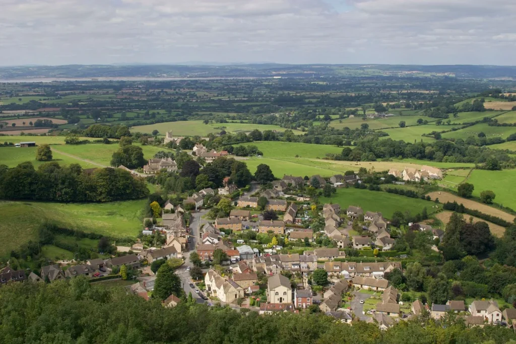
The Cotswolds are a band of limestone hills in south-central England, about 70 miles long, running from Bath in the south-west to Chipping Campden in the north-east. The protected area covers 790 square miles. Burford, its nearest well-known village, is 72 miles west of London, about 1 hour 47 minutes by car.
The Cotswolds on a map
Where: south-central England, west of Oxford and east of Gloucester
Shape: a narrow band from Bath (south-west) to Chipping Campden (north-east)
Size: 790 square miles, about 70 miles end to end
Highest point: Cleeve Hill, 330 metres, above Cheltenham
Outside the boundary: Cirencester, Cheltenham, Bath, Stroud and Oxford town centres
Below are two maps we drew from the official boundary data: one shows where the hills sit in England, the other the villages, stations and walking trail inside them. The sections after them explain what each part of the map means for a visit.
Where are the Cotswolds on a map of England?
The Cotswolds sit in south-central England, between Oxford to the east, Gloucester and Cheltenham to the west, Stratford-upon-Avon to the north and Bath to the south. On a map of Britain they look like a thin diagonal strip, roughly halfway between London and the Welsh border.
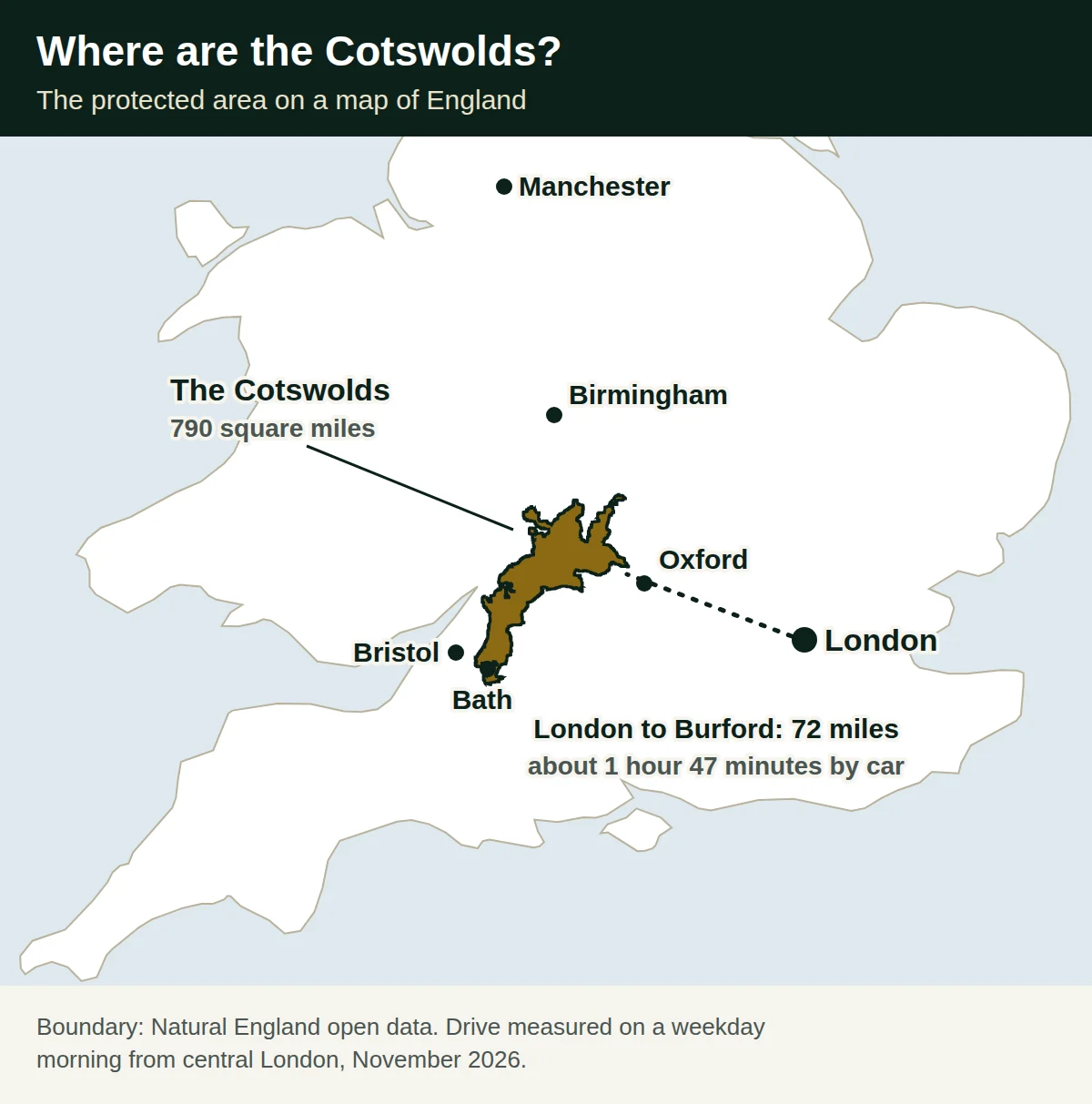
- From London: the eastern edge near Burford is 72 miles away; the far south at Castle Combe is 101 miles.
- From Heathrow: Burford is 62 miles, about 1 hour 22 minutes by car, because the airport is already on the west side of London.
- From Oxford: the boundary starts a few miles west of the city, around Witney and Charlbury.
- From Birmingham: the northern tip near Chipping Campden is the closest part.
Most visitors from London reach the eastern side first. Our guide to getting from London to the Cotswolds compares the train, coach and car door to door.
How big are the Cotswolds?
The protected Cotswolds cover 790 square miles, the largest of the 46 Areas of Outstanding Natural Beauty in England, Wales and Northern Ireland. The area has been protected since 1966 and is now called the Cotswolds National Landscape.
| Measure | Figure |
|---|---|
| Area | 790 square miles (2,041 square kilometres) |
| End to end | about 70 miles, from south of Bath to the far north-east |
| North to south | about 57 miles |
| Highest point | Cleeve Hill, 330 metres (1,083 feet) |
| Protected since | 1966 |
| Councils | parts of 15 local authority areas |
We measured the length and the north to south distance on the official boundary from Natural England. The hills stretch from Bath and Wiltshire in the south, through Gloucestershire and Oxfordshire, to Warwickshire and Worcestershire in the north.
Tip: the Cotswolds are not a county or a town, so you cannot type “Cotswolds” into a sat nav. Use the name of a village, such as Bourton-on-the-Water.
What does a map of the Cotswolds show?
A map of the Cotswolds shows a long, narrow area shaped like a leaf, with a steep western edge and gentle slopes falling away to the east. Our map marks the official boundary, the main villages, the nearest railway stations and the Cotswold Way trail.
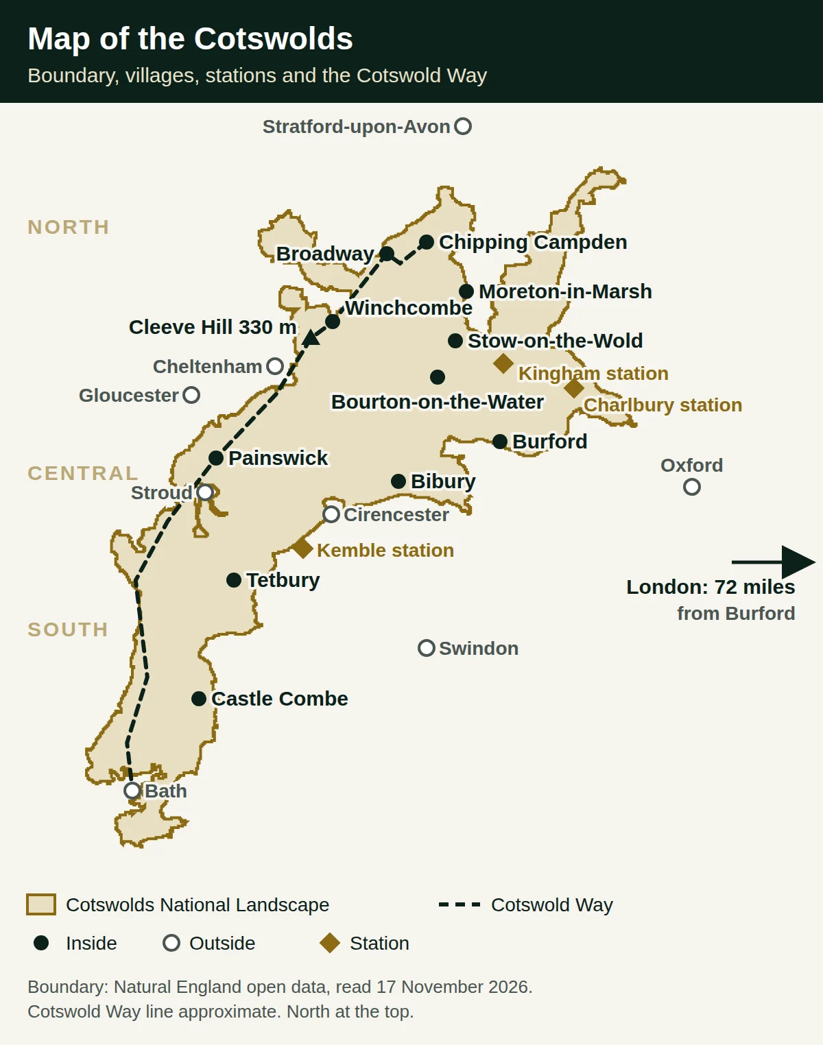
- The western edge: a steep escarpment above the Severn Vale and the Vale of Evesham. Cheltenham, Gloucester and Stroud sit below it.
- The eastern side: rolling high ground with river valleys, where Bourton-on-the-Water, Bibury and Burford stand.
- The northern tip: two fingers of land reach up around Chipping Campden and Ilmington.
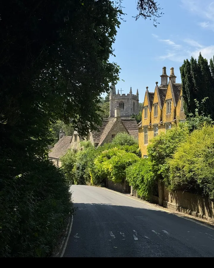
- The southern tail: a thin strip runs down past Castle Combe to wrap around Bath.
Which towns are inside the Cotswolds boundary, and which are outside?
Several towns often called Cotswold towns lie just outside the official boundary, including Cirencester, Cheltenham, Stroud and Bath. We checked each town centre against the Natural England boundary data on 17 November 2026.
| Place | On the official map |
|---|---|
| Chipping Campden, Broadway, Winchcombe | Inside, in the north |
| Moreton-in-Marsh, Stow-on-the-Wold, Chipping Norton | Inside, in the north-east |
| Bourton-on-the-Water, Burford, Bibury, Northleach | Inside, in the centre |
| Painswick, Tetbury, Castle Combe | Inside, in the west and south |
| Cirencester | Outside, on the southern edge |
| Cheltenham, Gloucester, Stroud | Outside, below the western edge |
| Bath | Outside, with the hills around it on three sides |
| Oxford, Woodstock, Blenheim Palace | Outside, to the east |
This matters little for a visit: Cirencester and Bath are still built of the same honey-coloured stone and make good bases. It does explain why some maps of “the Cotswolds” disagree, since tourist maps often include the gateway towns.
Castle Combe, though far south, is inside the boundary. Bath is a separate question; our guide to the best Cotswolds villages to visit covers which villages are worth the extra drive.
What is in the north, centre and south of the Cotswolds?
The north has the grand wool towns, the centre has the river villages closest to London, and the south has quieter villages near Bath. Splitting the map into three parts makes it easier to plan, because driving from one end to the other takes more than an hour.
North Cotswolds
- Main places: Chipping Campden, Broadway, Moreton-in-Marsh, Stow-on-the-Wold and Winchcombe.
- What you see: broad high streets of market halls and old inns, Broadway Tower on the ridge and Sudeley Castle near Winchcombe.
- From London: Chipping Campden is 94 miles, about 2 hours 16 minutes by car.
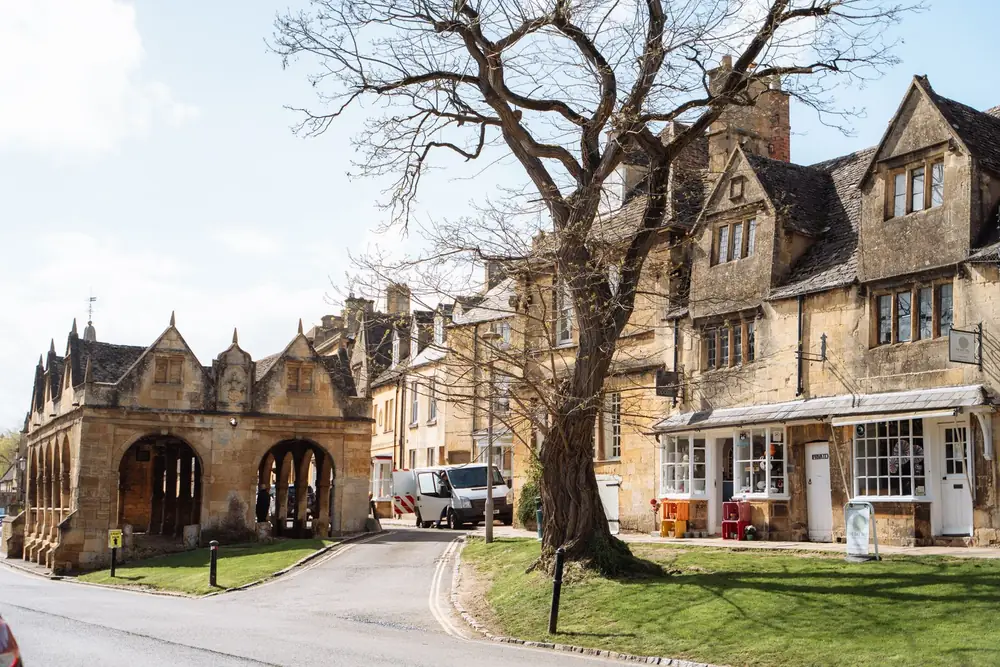
Central Cotswolds
- Main places: Bourton-on-the-Water, Lower and Upper Slaughter, Burford, Bibury and Northleach.
- What you see: shallow rivers under low bridges, Arlington Row in Bibury and wool churches.
- From London: Burford 1 hour 47 minutes; Bibury, Bourton and Stow about two hours.
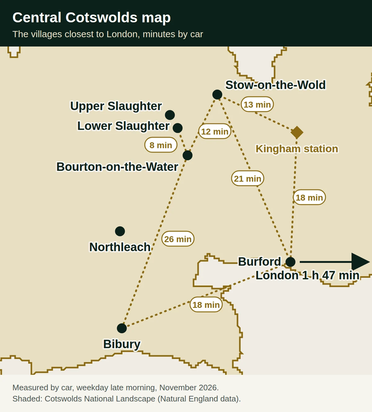
This is the part most London day trips cover. Our list of things to do in the Cotswolds shows what to do in each village and how long each stop takes.
South Cotswolds
- Main places: Painswick, Tetbury, Castle Combe and the villages above Bath.
- What you see: deep wooded valleys, silver-grey stone and fewer coaches than in the centre.
- From London: Castle Combe is 101 miles, about 2 hours 4 minutes, which is quicker than the distance suggests.
Where are the train stations on a Cotswolds map?
The nearest stations on the line from London Paddington are Kingham, Moreton-in-Marsh and Charlbury, all inside the boundary on the eastern side. Kemble, for Cirencester and Bibury, lies just outside the southern edge.
| Station | Nearest places by taxi or car |
|---|---|
| Kingham | Stow-on-the-Wold 13 minutes, Bourton and Burford 18 minutes |
| Moreton-in-Marsh | Stow 15 minutes, Chipping Campden 19 minutes |
| Charlbury | Burford 19 minutes |
| Kemble | Cirencester 12 minutes, Bibury 24 minutes |
| Chippenham | Castle Combe 15 minutes |
No station serves the river villages themselves, so the last few miles need a taxi, a bus or a car. The times above are drives we measured on a weekday in late morning in November 2026.
Where does the Cotswold Way run on the map?
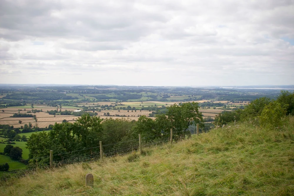
The Cotswold Way runs 102 miles along the western edge of the hills, from Chipping Campden in the north to Bath in the south. It is a National Trail, and it follows the escarpment for most of its length, so the views look west over the Severn Vale.
- Main points: Chipping Campden, Broadway Tower, Broadway, Winchcombe, Cleeve Hill, Painswick, Wotton-under-Edge and Bath.
- Highest ground: Cleeve Hill above Cheltenham, at 330 metres the top of the Cotswolds.
- Short walks: the stretch from Broadway Tower down into Broadway is downhill all the way.
Our map draws the trail as an approximate line through these points. For the exact path, use the National Trails map or an Ordnance Survey map.
Where can you get a printed or official map of the Cotswolds?
For walking, the best printed map is the Ordnance Survey Explorer OL45 “The Cotswolds” at 1:25,000. It covers the central area around Burford and Bourton-on-the-Water, with every footpath marked.
- Our printable map: the three maps on this page as a free 3-page A4 file, the printable Cotswolds map (PDF).
- OS Explorer maps: the whole area needs several sheets; OL45 is the central one, sold by Ordnance Survey.
- National Trails: a free online map of the Cotswold Way with stopping points and transport links.
- Cotswolds National Landscape: an interactive map of the landscape types across the protected area.
- Visit Cotswolds: pages for each town and village with their location.
- Phone maps: fine for driving between villages, but signal drops in some valleys, so download the area before you set off.
How do you plan a Cotswolds day trip from London with the map?
Pick one part of the map for one day: from London, the central villages work best because they are closest. Burford, Bibury, Bourton-on-the-Water and Lower Slaughter are all within 26 minutes of each other by car.
- One day: the central villages, starting at Burford on the London side.
- Two days: add the north (Stow, Chipping Campden, Broadway) on the second day.
- Three or more: add the south (Painswick, Tetbury, Castle Combe) or the length of the Cotswold Way.
- From Heathrow: a Heathrow to the Cotswolds transfer goes straight to your hotel in the hills.
Our private Cotswolds day trip from London costs £500 for the whole car, up to three passengers. It lasts about nine hours, and the driver waits at every village you choose. For a longer stay, there is a 5-day Cotswolds tour.

FAQ: Cotswolds map
Where exactly are the Cotswolds in England?
The Cotswolds are in south-central England, mostly in Gloucestershire and Oxfordshire, with smaller parts in Wiltshire, Warwickshire, Worcestershire and around Bath. They lie west of Oxford, east of Gloucester and Cheltenham, and about 72 miles west of London at their nearest well-known village, Burford.
How long are the Cotswolds from end to end?
About 70 miles, measured on the official boundary from south of Bath to the far north-east near Chipping Campden. From north to south the distance is about 57 miles. Driving from Castle Combe to Chipping Campden takes well over an hour, so most visitors explore one part at a time.
Is Cirencester in the Cotswolds?
Cirencester is usually called the capital of the Cotswolds, but its town centre lies just outside the official boundary, on the southern edge. The protected area starts at the edge of town to the north and west. For visitors this makes no practical difference: it is built in Cotswold stone and is a good base.
What is the highest point of the Cotswolds?
Cleeve Hill, above Cheltenham, is the highest point at 330 metres, or 1,083 feet. The top is on open common land near some radio masts, and the Cotswold Way passes close by. The best views are from the western edge of the common, looking over Cheltenham towards the Malvern Hills.
Which train station is in the middle of the Cotswolds?
Kingham and Moreton-in-Marsh are the most central stations, both on the line from London Paddington. Kingham is 13 minutes by taxi from Stow-on-the-Wold and 18 minutes from Bourton-on-the-Water. Moreton-in-Marsh is closer to Chipping Campden. No station serves Bibury or the Slaughters directly.
Is there a free map of the Cotswolds?
Yes. The National Trails website has a free online map of the Cotswold Way, and the Cotswolds National Landscape publishes an interactive map of the protected area. Our maps on this page show the boundary, villages and stations, and you can download them as a free printable PDF. For walking, buy the Ordnance Survey Explorer OL45 sheet.
Sources
Sources: the boundary, area and inside or outside checks from Natural England open data; size, protection date, counties and the escarpment from Cotswolds National Landscape; the Cotswold Way from National Trails; the height of Cleeve Hill from the Cleeve Common Trust; the OL45 sheet from Ordnance Survey; village pages from Visit Cotswolds. Drive times measured by us with Google route data on a weekday in November 2026. Read on 17 November 2026.